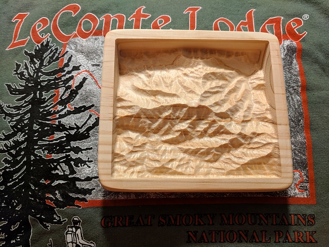
I have spent many a trip hiking Mount LeConte in the Smokies, and one of the projects that I thought I’d like to try out on a CNC router was carving a relief map (to scale) of LeConte and the surrounding area through which the five trails meander. I figured it was about time I got around to it, so…
Since I was working with a small area (something like 10km top to bottom), I needed high resolution elevation data. That being the case, first I grabbed the relevant 1m-resolution DEM (Digital Elevation Model) data from the USGS via The National Map. I used QGIS and the DEMto3D plugin to load the DEM data and render an STL file. A trip through MeshMixer to change it from an ASCII STL to a Binary STL was next, and then into PixelCNC to CAM it all up. A couple hours of machine time later, and tada! From a piece of scrap 2x6 to a piece of desk art.
I’m going to write up a full tutorial showing my work all the way through, step by step, in case anyone would like to do something similar. Once you have all the steps, it’s actually rather easy to make your own, but it took a bit of experimentation to make everything happy. Everything I used in the chain is free except PixelCNC (and if you already have MeshCAM, it may be a cromulent alternative there, but I can’t say for sure, as my trial attempts only ended in tears, er, crashes).
