The three volcanoes of N Oregon and S Washington

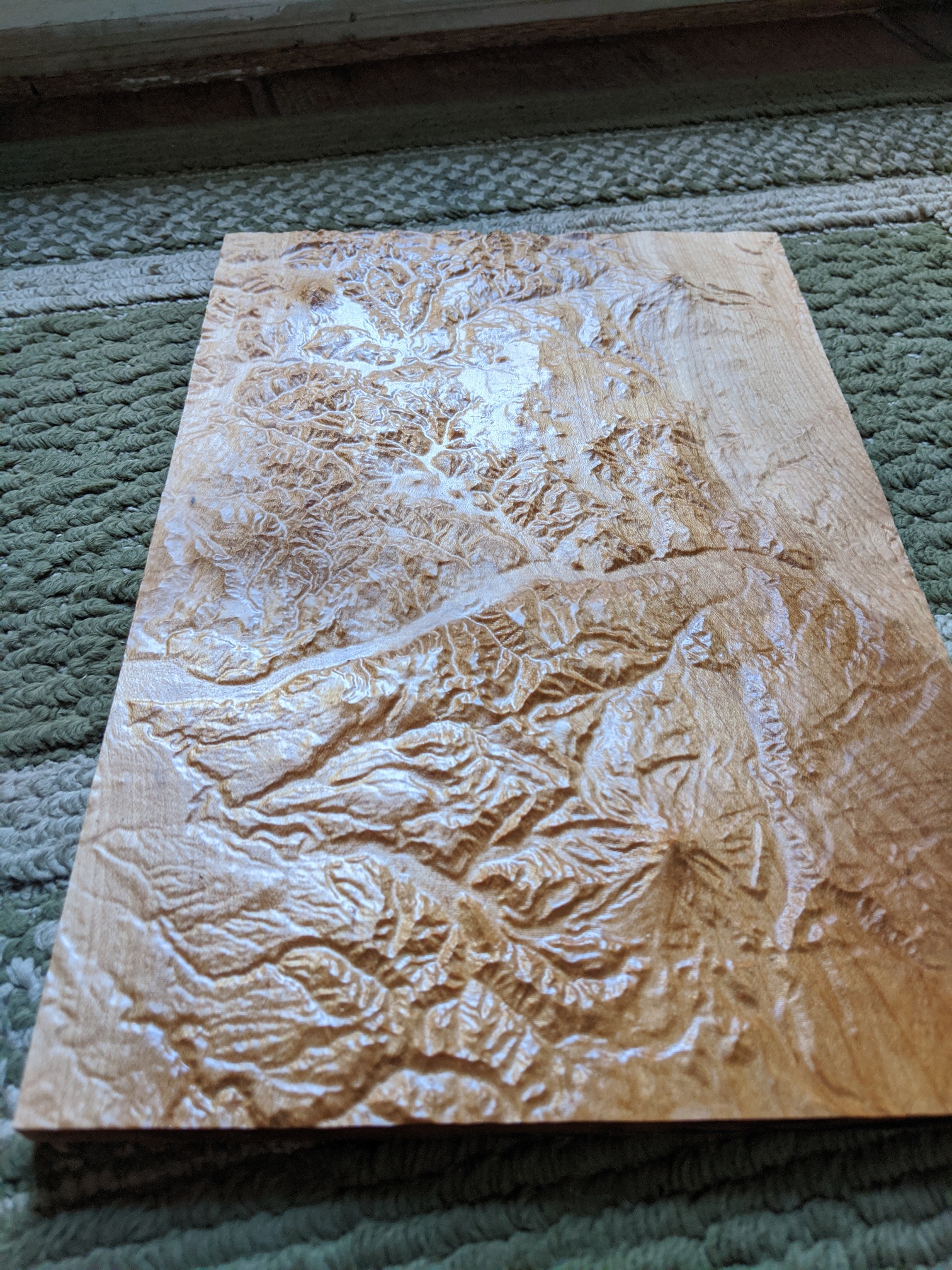
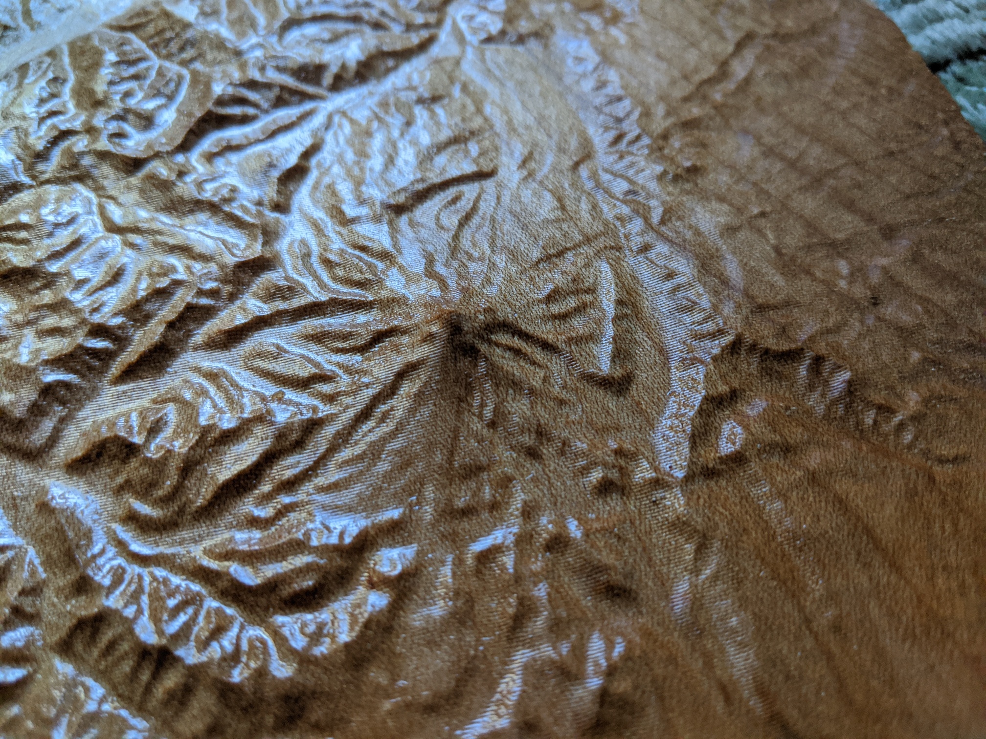
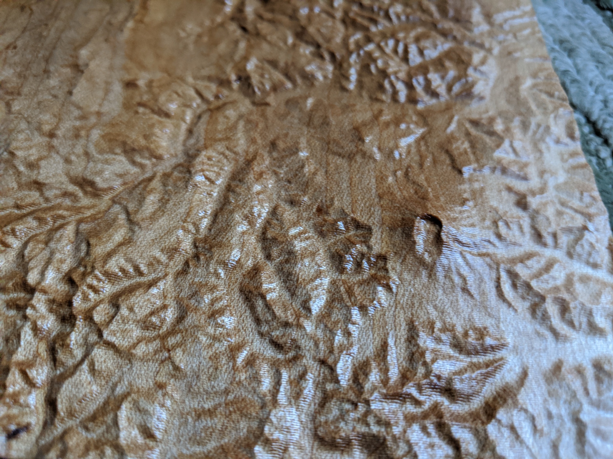
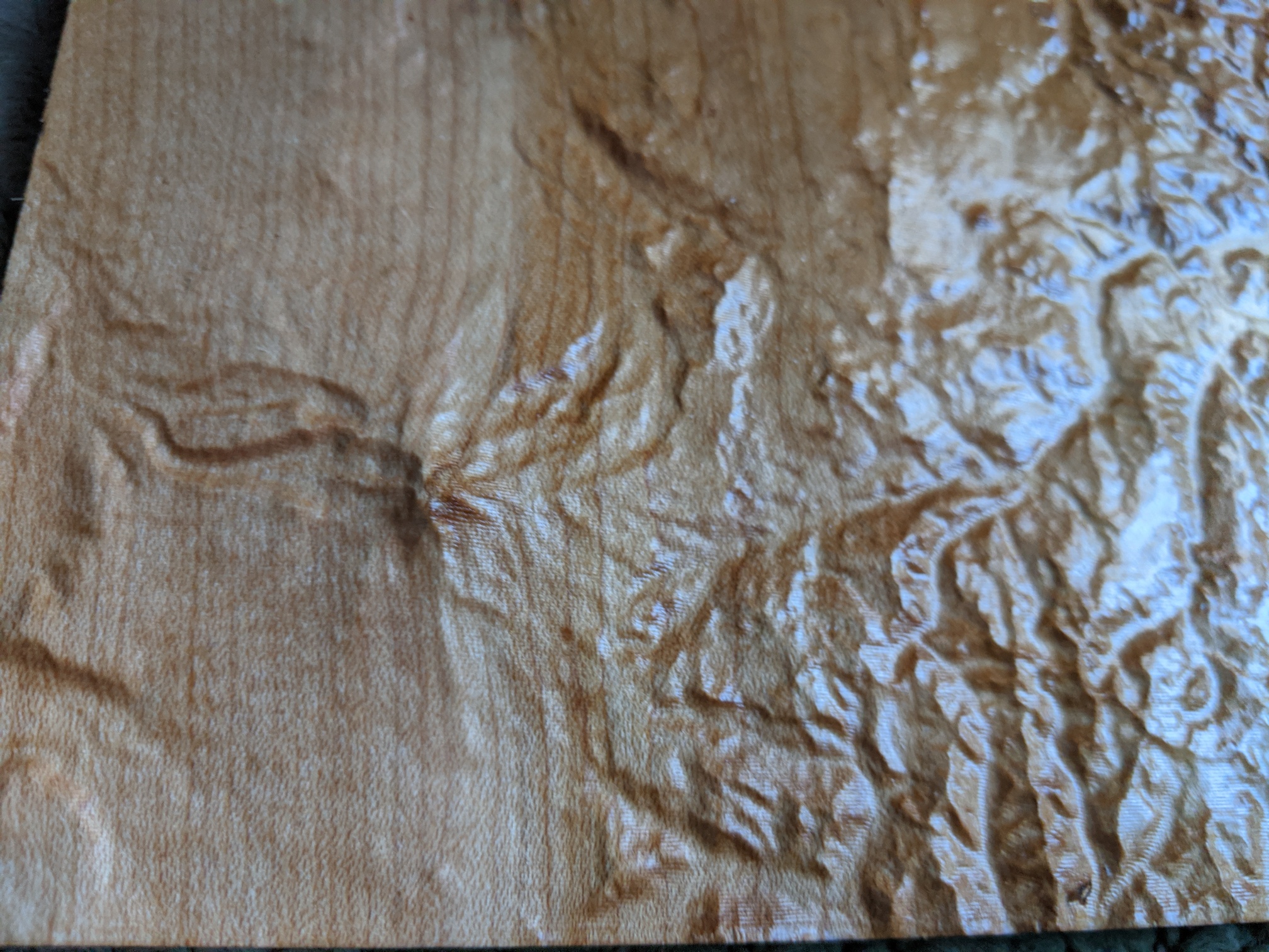
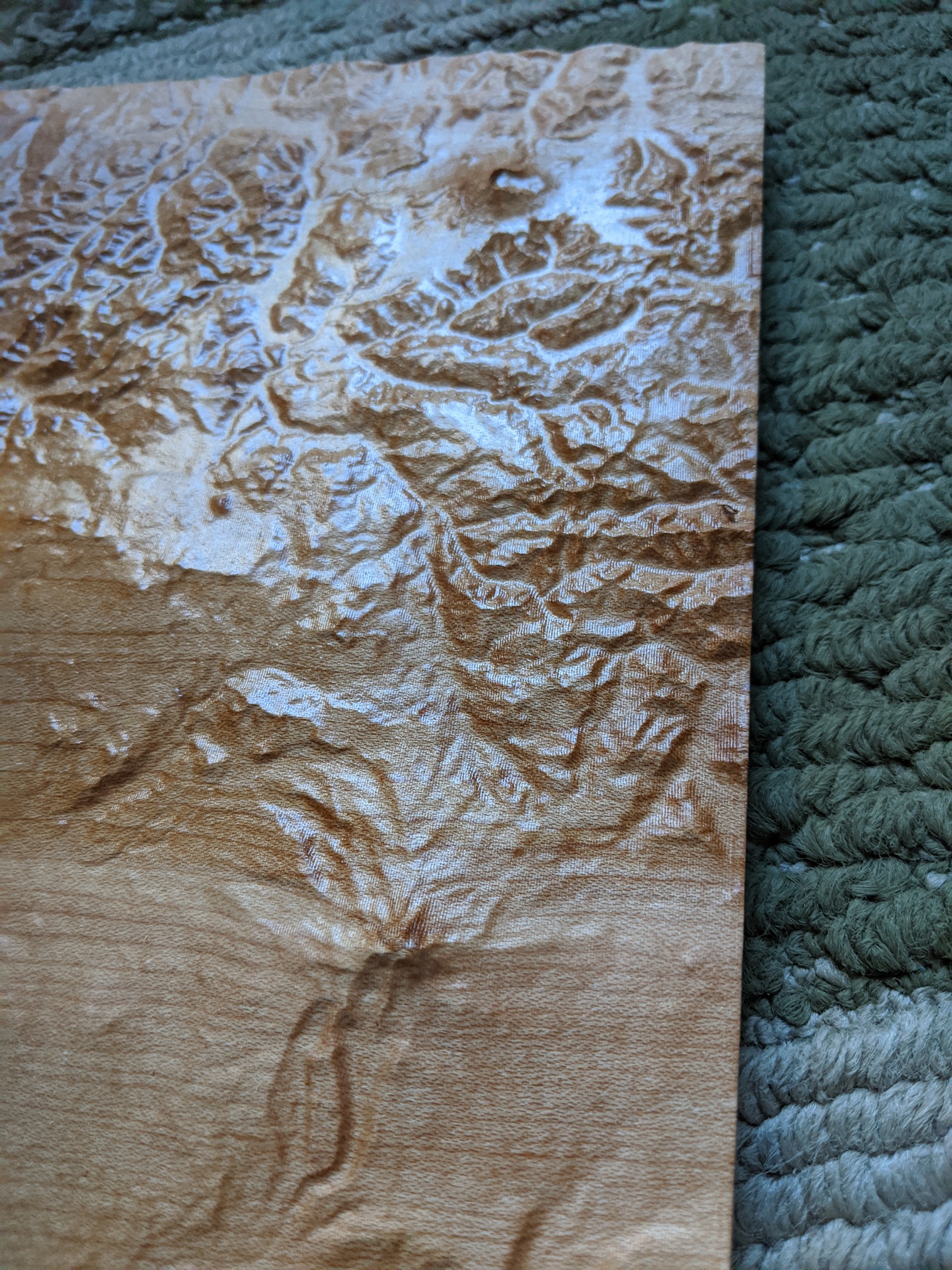
This cut took a lot longer than I expected, over 6 hours.
But the result is a 8" x 12" landscape with Mt Hood, Mt St Helens and Mt Adams to proper scale in one piece.

Mt Hood:

Mt St Helens, I like how you can see the blown top / lava flow are

Mt Adams:

and Mt Adams with Mt St Helens in the distance

This was created from an STL file from https://touchterrain.geol.iastate.edu/ with 2.8 million vertices. The roughing was done with a downcut 1/4" inch bit (50ipm, 0.05" DOC and 1mm stock to leave), while the finishing pass was with a 1mm diameter tapered ballnose bit (50ipm feedrate, 16ipm plunge) and a small stepover.

The gcode file was 43 megabyte in size, which the new Carbide Motion had no trouble with, other than estimating 3 hours 40 minutes instead of > 6 hours.

19 Likes

Nice ! that’s contest material :wink:

2 Likes

Holy smokes that is an awesome topographical cut! The detail level is killer! Would you mind sharing the settings used on the terrain website to get such detail in the file it spits out? I am a little lost trying to pick the best parameters.

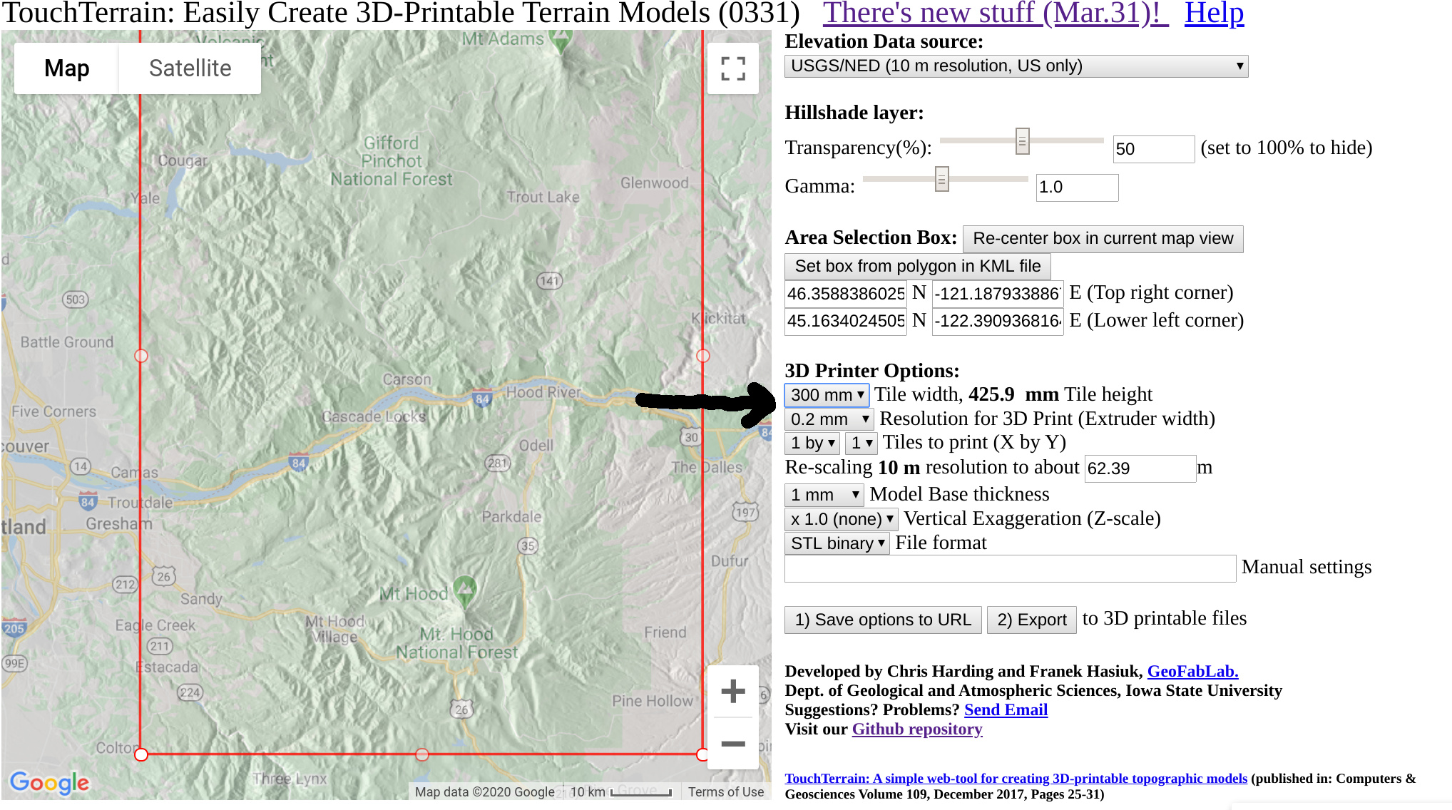
The two fields at the arrow I drew are key: Set the resolution of the 3D printer nozzle to 0.2mm and then set the tile width as large as you can get away with (the website has a size limit so need to pick the highest width to just be under that size)

The STL and gcode file I used can be found at http://git.fenrus.org/tmp/vulcanoes.zip (35Mb download)

(note that not all CAM software can deal with STL files of this level of detail… it might be a stretch for Fusion360)

3 Likes

What CAM software are you using?

Would I be correct in assuming your stl-to-png code/app would work with this level of detail? and that wonderful application is what you used to make the CC compatible png?

this was not made with CC… this level of detail is currently a bit beyond CC’s scope.

I wrote custom CAM software (https://github.com/fenrus75/FenrusCNCtools) that I used. The STL2PNG uses a lot of the same code, and if I get bored stuck at home I might port the whole thing to a web app …

The web tool can most certainly consume the STL (same code) obviously.

2 Likes

I am glad I asked. Thanks for the speedy reply!

CC is fine upto 5"x5" or so… 8"x12" is a stretch there.

So you can do the detail using stl2png and Carbide Create PRO… just upto maybe 5x5"

1 Like

I have been wanting to do the same for OSU’s McDonald Forest. Will have to look at your resource to see if I can dial it in from there.

with something of that size you can use STL2PNG - javascript edition to turn the STL into a PNG for use in Carbide Create Pro

2 Likes

I would love to get into topographical maps but have no idea where to start so please any advice for a newbie would be very welcome

Some resources at: https://wiki.shapeoko.com/index.php/Online_resources#Geography

but see:

1 Like

`@wmoy also did a video on this: https://www.youtube.com/watch?v=8eqRxFwYDmg

I did a few pages here on what I do as well (Red Pin Terrain carve and From STL file to Carbide Create (PRO) [screenshots included])

the page Will points at is the master for this obviously…

2 Likes

Wow what a reply thank you so much not sure I understand it all but more reading is needed.
Thanks again any other advice welcome.

Wow, great job. You can clearly see the Ridge of Wonders on the SE flank of Mt. Adams!

Julian, this answered my question I asked you. This is cool.